


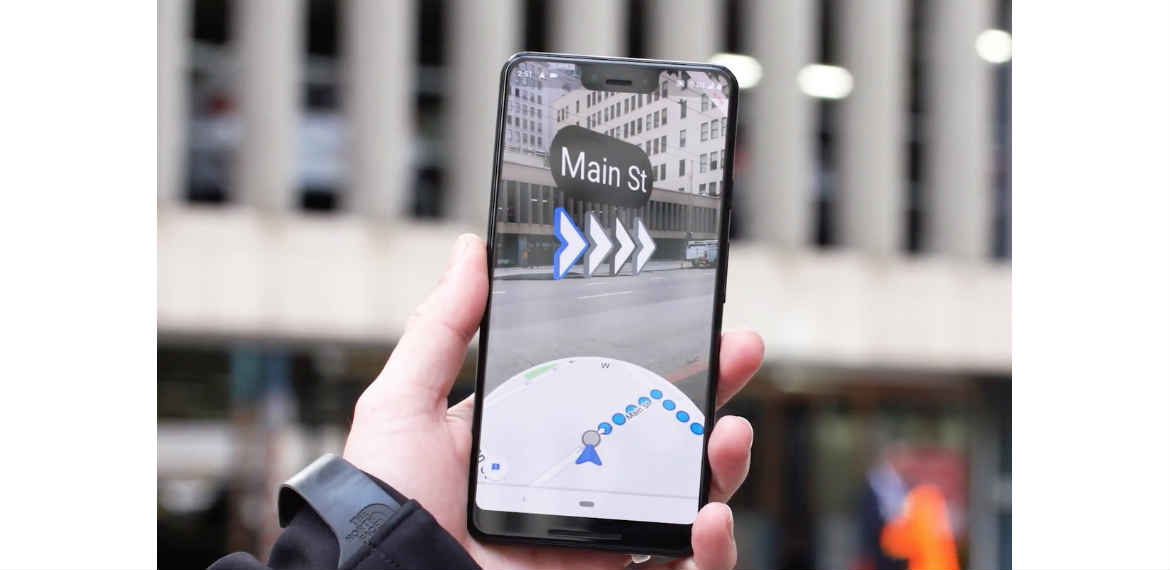
Google’s navigation app Google Maps is bringing augmented reality feature to some users which can pinpoint users’ exact location quickly and give more accurate directions from their phone’s camera in real time.
In an article published by fortune.com, the AR feature is set available to a small subset of Google Local Guides who agreed to add photos, reviews, and such to Maps.
The said feature shows digital street signs and virtual arrows overlaid on the sidewalk to help pedestrians navigate around cities.
Users can hold their phone up in front of them to see the AR version of Maps and an on-screen prompt will ask users to put their phone down after the correct route has been shown to pay attention to their surroundings.
UX Design Lead at Google said: “The blue dot you see of the 2D map is sometimes where you’re standing, but sometimes it’s jumping around and you’re not quite sure where you are.”
“It becomes even more exaggerated when you’re in an urban area because there’s tons of metal around us, other people’s phones, all these magnets — that problem is exacerbated. Using VPS and Street View gives us this whole new superpower,” she added.
Google is yet to decide if the feature will be available to all users.
(Photo source: theverge.com/ androidcentral.com)